cmip7 tunning at Locean
- tracking web code with Git
- CSS syntax
- Questions
- proof of concept
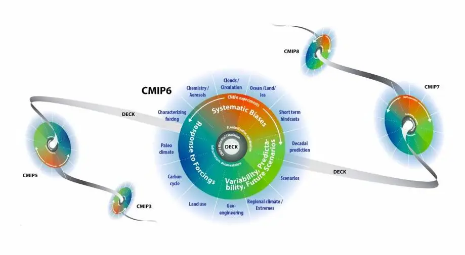
Atlas of (cmip5, cmip6 historical) & (cmip7 tunning) Experiences
There is no seasonal trend. Everything is based on data averaged over the 1989–2005 period!
Atlases are produced as part of the EUC_upwelling project, mostly focused on the Pacific (EUC) and Peruvian (Upwelling) regions.
- 46 cmip5 & 65 cmip6 available list
- another example of Use of the EUC_upwelling project for Locean studies on SENEGAL
-
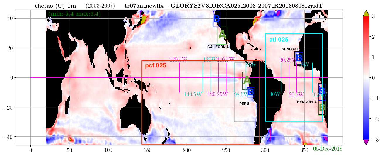
- Comparison of cmip 5,6 & 7 with the following observations, reanalyses & HR croco/wrf regional model (global or only on the region of Peru) :
- scow
- woa2009
- woa2023
- soda3.11.2_1980-2015
- soda3.12.2_1980-2017
- soda3.15.2_1981-2022
- glorys12v1.cmems_1993-2016
- glorys12v1.natif_1993-2005 (only on PERU area)
- glorys12v1.natif_2022-2025 (only on PERU area)
- anfc.glo12.cmems_2022-2025 (analysis forecast - only on PERU area)
- pech1236cow_pc12gp36pc025gp12ccoww_2006-2010 (croco/wrf 12/36° - only on PERU area)
- pech1236cow_pc12pc025cow_2006-2010 (croco/wrf 12/36° - only on PERU area)
- pech1236cow_pc12pc025gp12coww_2006-2010 (croco/wrf 12/36° - only on PERU area)
Processing control (global, Pacific & Peru)
IPSL (cmip5,6&7) & Complete (for all cmip projects) (fully updated on August, 2026)| IPSL | Complete | obs/reanalysis | cmip5 | cmip6 | cmip7(tunning) |
| cmip5,6 & 7 | thetao | 12 | 46 | 65 | 3 |
| cmip5,6 & 7 | so | 12 | 41 | 65 | 3 |
| cmip5,6 & 7 | uo | 10 | 46 | 65 | 3 |
| cmip5,6 & 7 | vo | 10 | 41 | 64 | 3 |
| cmip6 & 7 | wo | 6 | 42 | 3 | |
| cmip5 & 6 | wmo | 31 | 39 | ||
| cmip6 | hfdsO | 8 | 27 | 56 | |
| cmip5 & 6 | o2 | 2 | 14 | 15 | |
| cmip5 & 6 | no3 | 2 | 19 | 19 | |
| cmip5,6 & 7 | tauuo | 6 | 23 | 51 | 3 |
| cmip5,6 & 7 | tauvo | 6 | 22 | 51 | 3 |
PERU isodepth
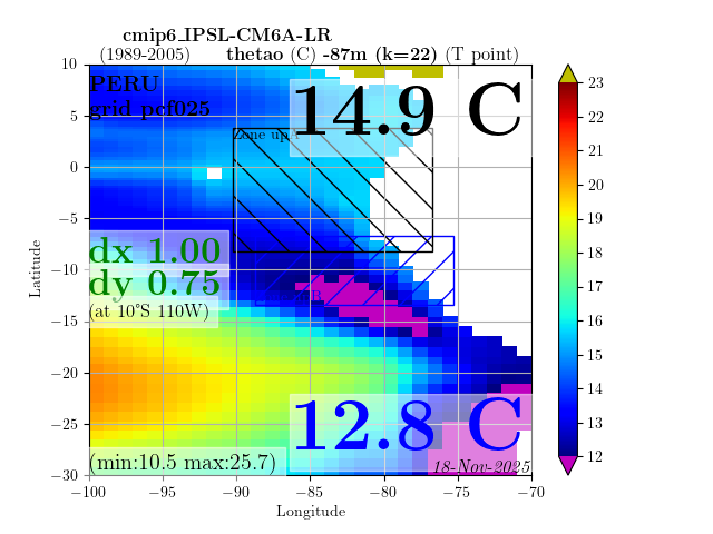
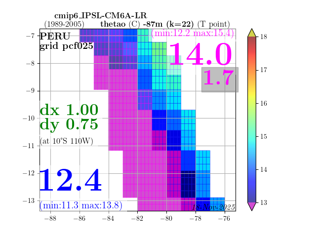
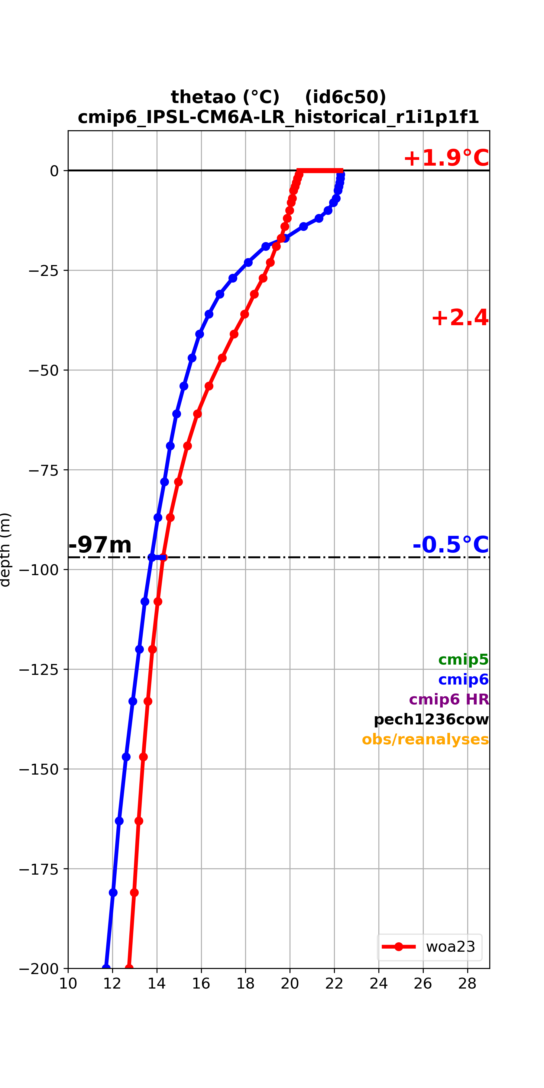
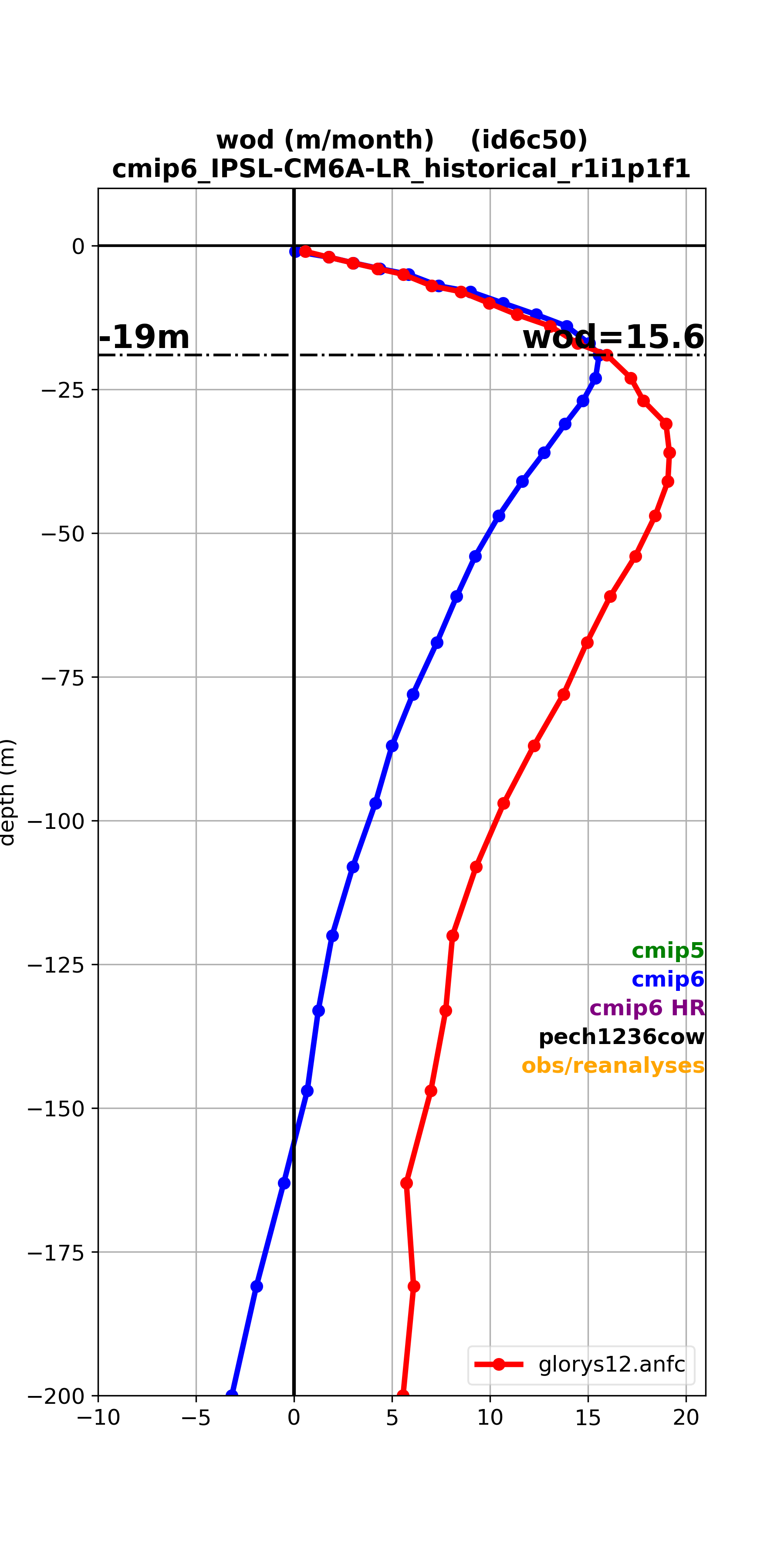
- depth : sst, 31m, 54m, 87m, 120m, 31-108m, 54-108m, 69-133m, 181m
- (fully updated on August, 2026)
- thetao : IPSL cmip5,6 & 7 - complete
- so : IPSL cmip5,6 & 7 - complete
- wo : IPSL cmip6 & 7 - complete
- wod : IPSL cmip5 & 6 - complete
- hfdsO : IPSL cmip6 - complete
- o2 : IPSL cmip5 & 6 - complete
- no3 : IPSL cmip5 & 6 - complete
- tau grid 025
- tau (OLD False Mask U/Tau mesh 0.25 612): complete
- tau (OLD False Mask U/Tau mesh 0.25 612 REMADE): IPSL cmip5,6 & 7 - complete
- tau (mesh 0.25): IPSL cmip5,6 & 7 - complete
- tau grid native
- 5 obs & 1 cmip6 excluded because < 0.25
- (2 glorys12v1.natif, 3 pech1236cow & cmip6_HadGEM3-GC31-HH_hist-1950)
- tau (native grid mesh): IPSL cmip5,6 & 7 - complete
- tau (native grid mesh cumulated): IPSL cmip5,6 & 7 - complete
Pacific Sections
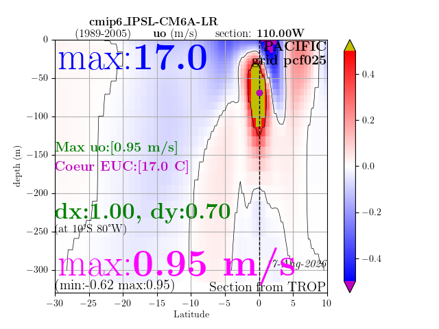
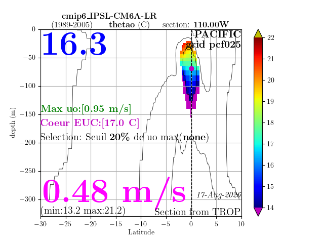
- sections : 85W, 98.5W, 110W, 120.25W, 130W, 140.5W, 170.5W
- (fully updated on August, 2026)